Final seminar SUDOE MONTCLIMA: climate and natural risks in the mountains of the SUDOE territory.
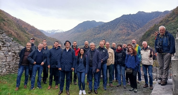
On the 23rd of November 2022, the final seminar of MONTCLIMA was held in cité administrative of Toulouse followed by a field visit to the STePRIM programme: "Territorial strategy for mountain risk prevention" Bagnères de Luchon on the 24th of NovemberAfter 42 months of hard work between 9 partners from France, Spain, Andorra and Portugal, this event was a great opportunity to proudly present the project final results, meet the project partners and exchange knowledge with the main actors and experts in the field. Around 70 people attended the seminar and engaged in enriching meetings essential for the continuity of cooperation actions to better manage and prevent the natural hazards in Southwest European (SUDOE) mountain areas, that are likely to increase in a climate change context.
At 10 am the seminar started with a speech by Eva García, the OPCC coordinator welcoming the attendees who joined the seminar remotely and on site, followed by an institutional opening by Zoé MAHÉ, the NA of the Interreg SUDOE program, and Ibon MENDIBELZUA, from the CTP general secretariat.
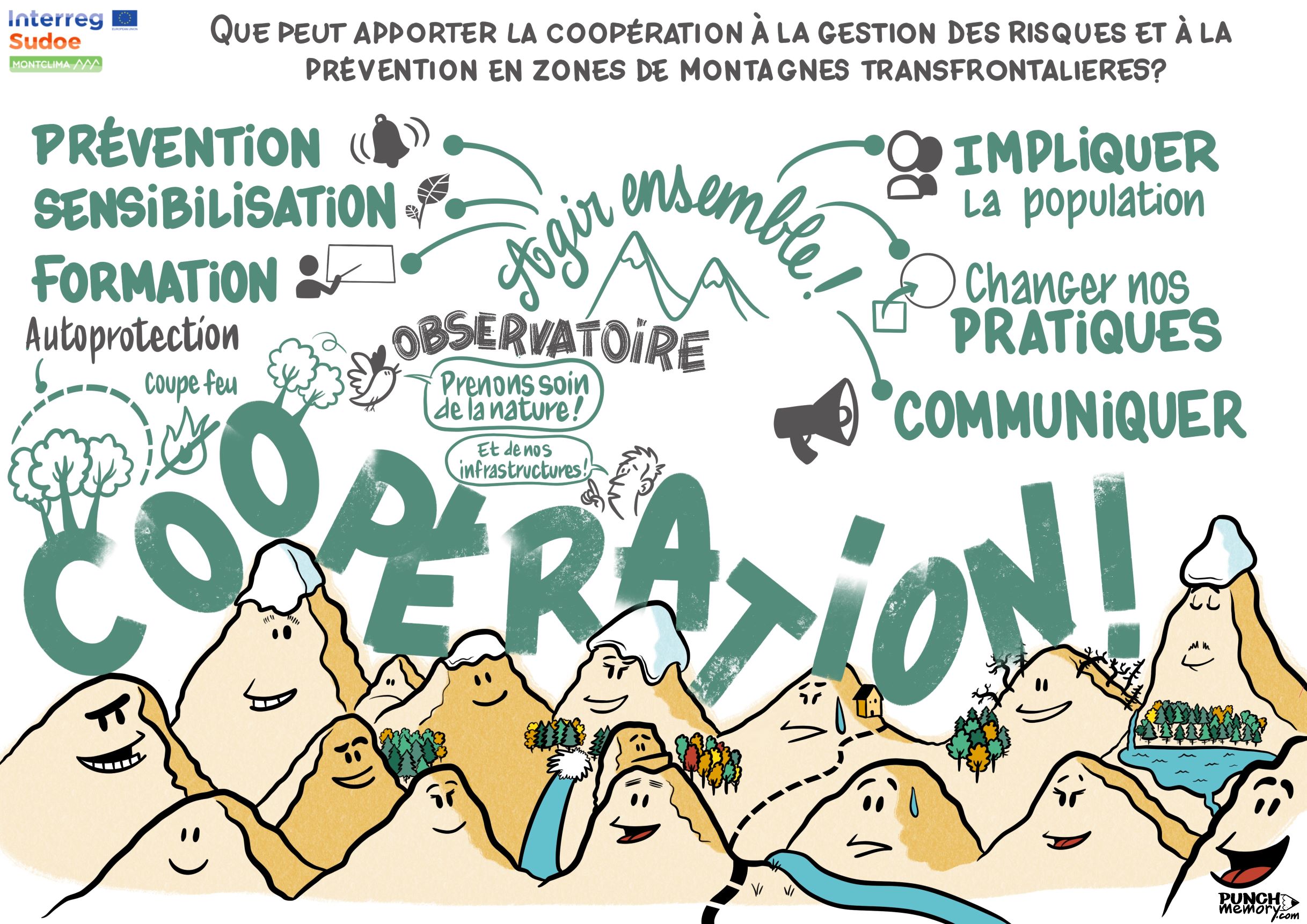
The seminar was divided into 3 main parts centered around the main project strategic objectives, capitalization of successful good practices, test of strategies via demonstrative plots, and strategic framework for the natural hazards management in SUDOE mountains. At last, a round table discussion gathered 5 of the main actors around the topic of cooperation role in the risk management and prevention in cross-border mountain areas. Juan Terrádez concluded the seminar by summarizing the essential conclusions and take-home messages, while being accompanied by wonderful illustrations conclusions by Guillaume Lefevre (Punch Memory).
Do not worry if you could not join us in this seminar, below you will find the presentations summaries of our guest speakers!
The first part of the day was a great introduction into the world of existing information, projects, and innovative technical and legal instruments, regarding the natural risk management tools for mountain areas at the European scale and in the SUDOE.
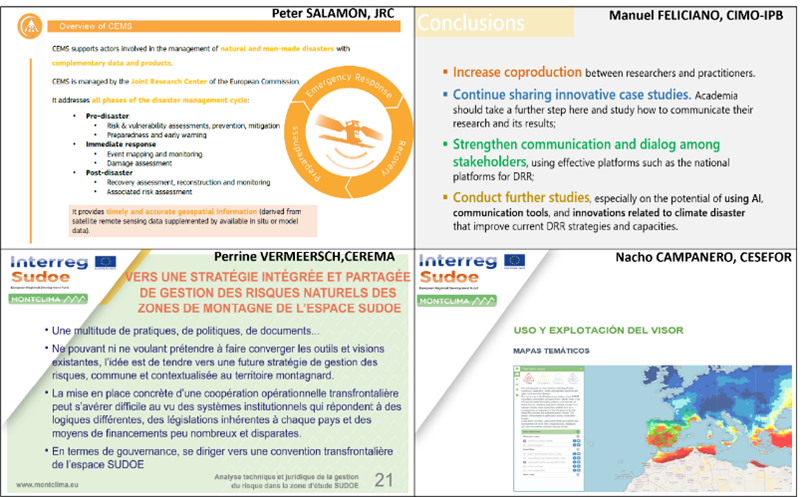
The Copernicus Emergency Management System (CEMS) coordinator, Peter SALAMON thoroughly presented the CEMS developed for the management and prevention of major natural and climatic hazards in Europe, based on satellite imagery, remote sensing, and impact models. The CEMS offers key information for the whole emergency management cycle, including the management and prevention phase (early warning and weather forecasting), as well as the post-disaster recovery phase. Peter mentioned the continuous development of new products, such as detailed exposure mapping, interconnected to the emergency and Civil Protection services. As for the early warning and monitoring system, the CEMS systems automatically provide real time monitoring data of these risks (fires, floods, droughts) through various systems (EFAS, EFIS, EDO, GloFAS, GFM, GDO).
As part of the 1st strategic objective of MONTCLIMA, Manuel FELICIANO from CIMO-IPB described the capitalization action that consisted of analyzing 72 best practices in flood, drought, fire and drought risk management and prevention in the SUDOE mountain area, collected from various projects and initiatives. This task was complemented by selecting 27 good practices that respond to climate change in mountain areas, from a multi-risk perspective, while highlighting the added value of cross-border cooperation: https://www.montclima.eu/en/best-practices
Subsequently, Perrine VERMEERSCH from CEREMA, introduced the MONTCLIMA report on the state of the art of technical and legal instruments on the management and prevention of natural and climatic risks in the SUDOE area. The report aims to better understand the different modes of governance, plans and strategies of each country to reduce the risk of natural hazards. Therefore, each project partner contributed via a questionnaire on the legal and technical documents of major importance for risk management. Perrine highlighted one of the innovative initiatives to reduce the natural risks established in the Pyrénées Haut Garonnaises: STEPRIM (Stratégie Territoriale pour la Prévention des Risques en Montagne) that is based on a participatory, inter-regional, multi-risk approach, with a perspective of adaptation to climate change and in the mountains.
At last, in just a few clicks, you can access all the available cartographic information on these 4 risks in the SUDOE mountains via the MONTCLIMA map viewer presented by Nacho CAMPANERO from CESEFOR. This tool gathers more than 200 datasets on past, present and future evolution of the four hazards in SUDOE mountain areas, and presents cartographic information of the 7 MONTCLIMA pilot cases. Customized queries on the observed and projected evolution of these hazards can be easily done in this map viewer: https://www.montclima.eu/en/geoportal
Following the Q&A session concluding the morning lectures, we proceeded with the SECOND PART OF THE SEMINAR centered around the observed trends and different strategies tested in MONTCLIMA pilot cases to improve the resilience of mountain territories.
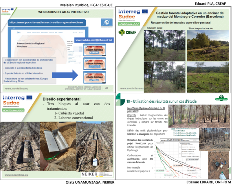
First, Maialen lTURBIDE from the IFCA: CSIC-UC, described the IPCC interactive atlas which provides regionalized information on the assessment of the main meteo-climatic variables or drivers of natural hazards and risk-bearing events. Maialen highlighted the regional synthesis section, which analyzes a subset of climate indices while presenting the degree of confidence and the statistical significance of the different observed and predicted trends.
Later, a series of MONTCLIMA pilot cases were presented. Eduard PLA from CREAF outlined the pilot case of adaptive forest management in a strategic management point (SMP) in Cataluña, for the control of large forest fires. A series of forest management interventions have been carried out in the holm oak forest to act as a barrier to large fires, and to strengthen the resilience of the forest mass to natural and climatic risks (drought and fires).
Moreover, the erosion issue in mountain areas is strongly present. Therefore, one of the tested strategies was the soil conservation management implemented in a pilot case described by Olatz UNAMUNZAGA from NEIKER. The main objective was to investigate the reduction of erosion in vineyards by testing two treatments: natural vegetation cover and conventional tillage. The pilot experience shown that conservative soil management prevents soil erosion by more than 50%, without having a significant negative impact on production. Olatz pointed out the importance of model validation with data from such pilot cases to better guide the policy making process.
Another tested strategy concerning the erosion phenomena was implemented in the third pilot case presented by Etienne EBRARD from ONF-RTM on the characterization of erosion phenomena after a fire in the municipality of Cerbère. The first results showed that the areas affected by the fire erosion have significantly higher surface runoff and react earlier even to low rainfall events. Etienne highlighted that efficient erosion control should focus on soil recovery rather than reforestation following a major fire.
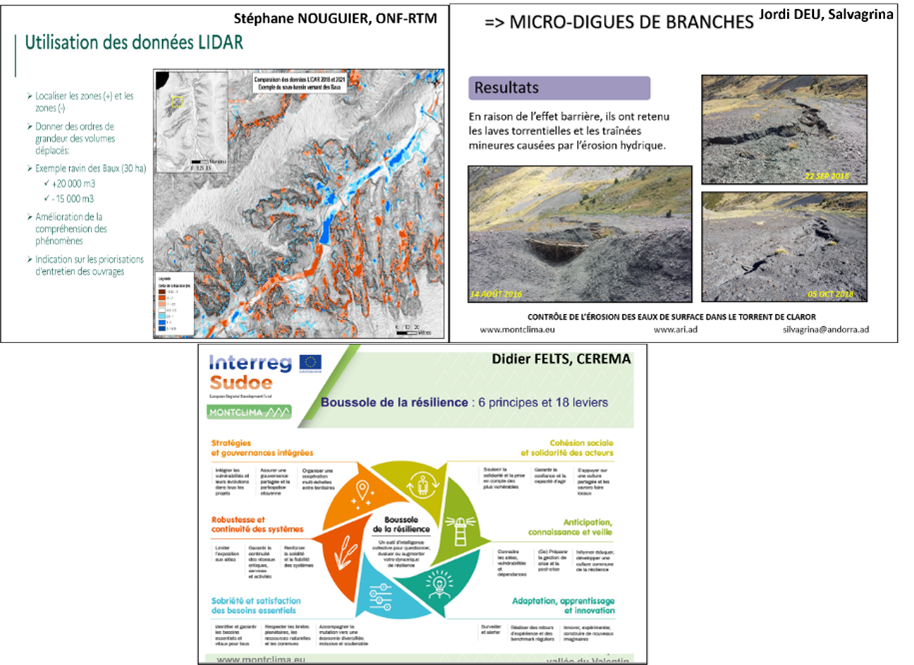
In the same context, Stéphane NOUGUIER from ONF-RTM featured the pilot case on the evaluation of the erosion phenomena in Mediterranean mountain catchment after the Gloria extreme storm, using the LIDAR (Light Detection and Ranging) technology. Through comparing the LIDAR data before and after the storm, it was possible to characterize and quantify (although with limitations) the erosion and deposition phenomena with a considerable resolution (limit of 20/30 cm). Stéphane concluded by stating that extreme events although less frequent, have a very important impact to be taken into account in resiliency strategies.
On another hand, nature-based solutions were considered when it comes to mitigating the problem of torrential lavas upstream of a drinking water plant in Andorra. Jordi DEU from Salvagrina described the methodology implemented using degradable dikes in the main gullies, revegetation by seeding (Festuca eskia) and natural fertilization of the affected area from the livestock passage "ovinoremediation". The combining of nature-based measures has successfully proved to be effective reducing the risk of erosion in this protected mountain area.
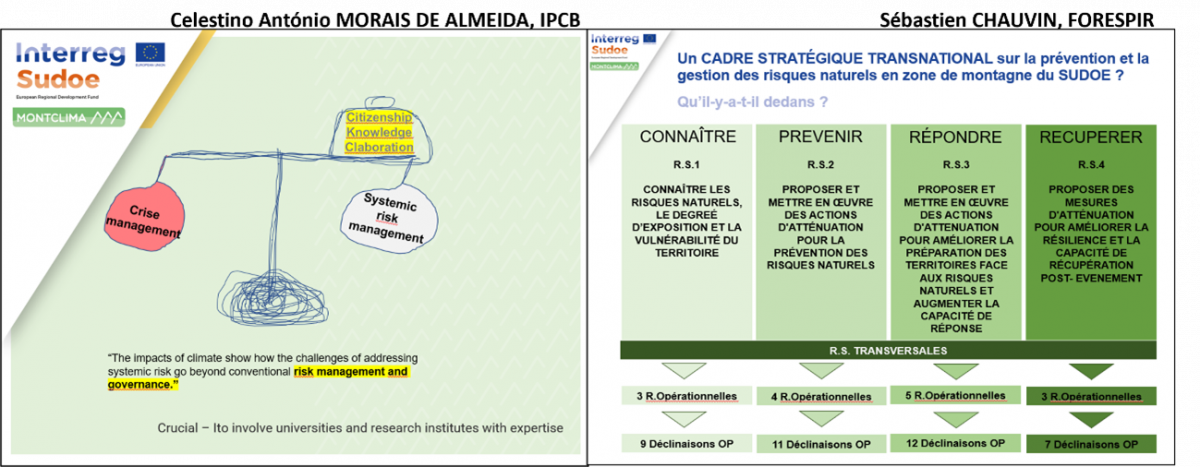
At last, to conclude this series of innovative testing plot strategies, Didier FELTS from CEREMA talked about a resilience initiative carried out through participatory workshops in the Valentin Valley. Based on a multi-risk characterization of the area, all key stakeholders were involved in the definition and prioritization of measures to improve the prevention and management of natural and climatic risks. Didier pointed out the key words in this strategy: mobilization and co-creation in favor of the territory resilience, consideration of the learned lessons and shared knowledge of the key actors.
THE THIRD AND LAST PART OF THE SEMINAR was centered around the strategic transnational framework developed in MONTCLIMA to guide and manage the cross-border hazards.
As a practical example of transnational cooperation, Celestino António MORAIS DE ALMEIDA from IPCB mentioned the civil protection collaboration protocol between Spain and Portugal for forest fire management since 2019. This allows the operation of extinguishing services in the neighboring country simply by informing in advance and sharing real time information. Celestino brought attention to the fundamental continuity of joint strategies and interventions in risk management and prevention.
A very important pillar of the MONTCLIMA project is the strategic document “reference” with strategic and operational recommendations to improve the management and prevention of natural risks in SUDOE mountain areas. Sébastien CHAUVIN from FORESPIR presented an overview of the document that is based on the capitalization of existing technical, legal and best practices information, and complemented by the strategies of MONTCLIMA's own pilot cases. In addition, this document has been consulted by international experts and crossed with the knowledge acquired in a series of 4 transnational seminars on the different subjects.
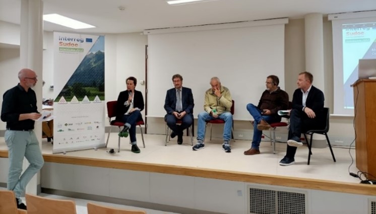
At last, a very interesting ROUND TABLE DISCUSSION gathered actors from different backgrounds to exchange knowledge and key strategies, fundamental in the cooperation world. The main key messages are the following:
Froilan SEVILLA from Castilla y León regional government: Incorporation of climate change adaptation in forest management through (1) applying measures to protect settlements, (2) improving the road network and forest tracks, (3) ensuring good soil quality, (4) preventing pastoral burning and accidents.
Luís QUINTA-NOVA from CLIMRisk project: It is necessary to promote adaptation measures and to raise awareness among the population so that it becomes a participant. The key point is to communicate the need to readapt adaptation measures in an iterative manner as climatic conditions change.
Delphine MERCADIER-MOURE from the Commissaire de Massif, Pyrénees: Strategic projects such as pocrisc, allow signing conventions between territories (systemic risks), with exchanges of testimonies between massifs to achieve a better coordination of risk and climate change policy in the Pyrenees.
Philippe CHAPALET the Head of natural hazards service, DREAL: The challenge is precisely to align/define common methodologies that facilitate collaboration and monitoring of hazards evolution, and to ensure the sustainability of risk management mechanisms in the mountains.
Cristian PONS the Head of Civil Protection, Andorra: There are 2 typologies of risks, localized risks (ie.avalanches) and diffuse/global geological risks. Agreements between Andorra and France regarding avalanche risks have been signed and cross-border projects are underway. Real-time communication with French departments and feasibility is key.
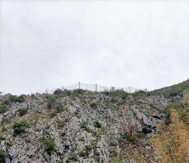
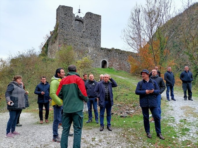
At last, the field visit on the 24th of November was the perfect occasion to know more about the STePRIM project, making this territory the first mountain territory in the Pyrenees to have a multi-risk strategy for the management and prevention of natural and climatic risks. The day ended with field visits to the structures designed to protect the region around slopes from falling rocks include mesh or cable nets, barriers and fences.
In conclusion, it is important to point out on the emergency context reconfirmed by the scientific community in the sixth IPCC report, stating the progressive increase of climatic extremes such as droughts, heat waves and intense precipitation throughout the Mediterranean basin. And because actions speak louder than words, MONTCLIMA is an innovative project promoting cooperation actions and tested innovative strategies to be replicated and adapted to other mountain areas to improve the resilience of mountain territories to natural and climatic hazards.
A summary of the project results can be downloaded here.
Here you can download also the presentations of te seminar.


PYRENEAN CLIMATE CHANGE OBSERVATORY
Avenida Nuestra Señora de la Victoria, 8
22.700 - Jaca
Huesca - España
+34 974 36 31 00
info_opcc@ctp.org